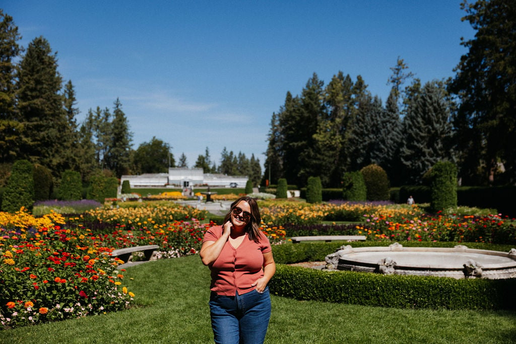
As a born and raised local to Spokane, Washington, I take great pride in offering my clients extensive knowledge of Spokane and its unique neighborhoods. As Spokane has grown, its neighborhoods have developed even more unique character and distinct micro-cultures. Knowing this information intimately helps me parse out the small details that might make one neighborhood a better fit for a family than another.
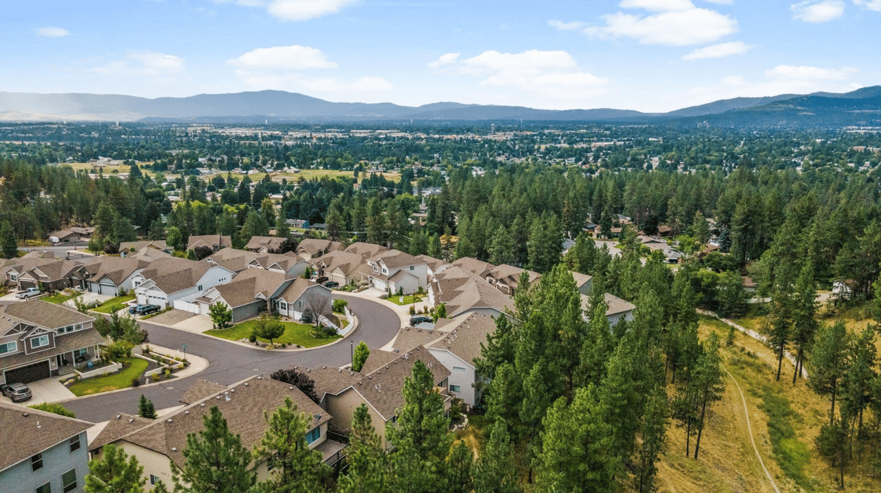
Spokane is divided into 29 officially recognized neighborhoods by the city, each with its own unique character and community. Below I will give an overview of each community with links to City of Spokane resources, as well as my “Samara’s Picks” for community spaces or businesses that are a can’t-miss in that area. These neighborhoods are organized into three districts: Northeast (District 1), South (District 2), and Northwest (District 3). Each neighborhood has a Neighborhood Council that works to maintain and improve the quality of life in the area. I’m including a link to each neighborhood council website and some additional city links that can give you more information.
This is part three of a three part series focused on the District 3 neighborhoods in Northwest Spokane. You can a view part one and part two at the respective links!
District 3: Northwest Spokane
Audubon-Downriver
This neighborhood is adjacent to the Spokane River and Downriver Golf Course. It features parks and a mix of housing options.
Samara’s Picks
-
The trees and views at Downriver Golf Course are incredible
-
Audubon Park is gorgeous. I’ve mentioned it before in my Audubon-Downriver neighborhood spotlight.
-
The Flying Goat has the best pizzas, a great patio and the best everyone-knows-everyone vibe.
Audubon-Downriver Overview
Audubon-Downriver is a historic and established neighborhood defined by its close proximity to downtown and its natural features, with the Spokane River forming its southern and western boundaries. Originally a winter camp and fishing location for local Native American tribes, it transformed into a modern residential district in the early twentieth century heavily supported by the extension of streetcar lines. The area boasts tree-lined streets, expansive stands of mature ponderosa pines, and landmark amenities like Shadle Park—home to a public swimming pool, community library, and the iconic green-and-yellow Shadle water tower. It features a predominantly residential layout with a few isolated commercial pockets where residents gather at cozy neighborhood cafés and pubs.
Audubon-Downriver Demographics
The Audubon-Downriver neighborhood has a population of approximately 8,813 residents. Demographically, the population identifies as 90.3% White, 5.2% Latinx, 1.5% Asian, 1.3% American Indian/Alaska Native, and 1.2% Black. The neighborhood is primarily composed of upper-middle-income residents and features stable, well-established housing built mostly between 1940 and 1969. A notable 13.6% of the workforce is employed in local, state, or federal government jobs.
View the Audubon-Downriver Neighborhood Map
Balboa/South Indian Trail
Indian Trail offers modern builds with opportunities for views.
A primarily residential area, this neighborhood offers suburban living with access to parks and schools.
Samara’s Picks
-
It’s proximity to Riverside State Park is a highlight that I’ve mentioned before.
-
In or near the 5-Mile Shopping Center you can find some great dining options like Cascadia Public House and Das Stein Haus
Balboa/South Indian Trail Overview
The Balboa/South Indian Trail neighborhood is an established, clean, and family-oriented community centered around a centuries-old trail historically used by Native Americans. In 1883, pioneer Robert McKinley built a home and a camp here known as "Indian Springs," which served as the only drinking water source for travelers crossing between the big river and the Little Spokane River. The neighborhood transitioned from rural land into a thriving suburb after it was annexed into the city in 1956, leading to a post-war housing boom and the construction of local anchors like Balboa Elementary, Indian Trail Elementary, and Salk Middle School. Today, residents enjoy well-maintained yards, a low cost of living, and proximity to neighborhood-serving retail clusters along Francis Avenue.
Balboa/South Indian Trail Demographics
The Balboa/South Indian Trail neighborhood has a population of approximately 5,645 residents. Demographically, the population identifies as 90.2% White, 4.8% Latinx, 2% Asian, 1.6% Black or African American, and 1% American Indian/Alaska Native. The built environment consists primarily of mid-sized to larger single-family homes with large suburban building lots, complemented to a lesser degree by pockets of duplexes and apartments.
View the Balboa/South Indian Trail Neighborhood Map
Browne's Addition
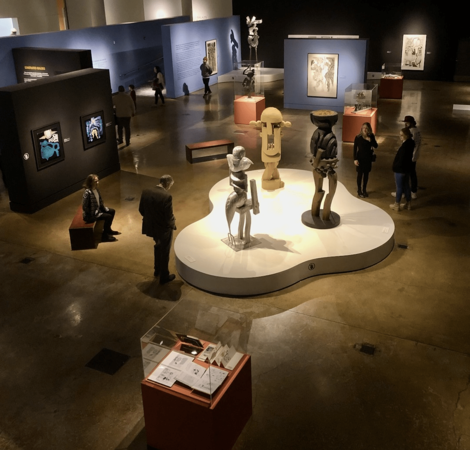
The Northwest Museum of Arts and Culture is a contemporary building with world-class exihibitions. Photo courtesy of @northwestmuseum
Browne's Addition is Spokane's oldest neighborhood, known for its historic mansions and diverse architecture. It's home to Coeur d'Alene Park and the Museum of Arts and Culture.
Samara’s Picks
-
The Northwest Museum of Arts and Culture and nearby Campbell House are both a must see in this neighborhood.
-
The Elk Public House and its little sibling, El Que, a tiny tequila bar by the same owner, are great dining options here.
-
Spokaneites from all across town visit this neighborhood for Italian Trattoria’s hand crafted, fine dining.
Browne's Addition Overview
Browne's Addition has a rich history that began in 1878 when J.J. Browne platted 160 acres west of town, transforming a thinly populated landscape into Spokane’s premier elite community. Rapid fortunes made in real estate, mining, and lumber allowed prominent residents to construct extravagant mansions designed by leading architects in Queen Anne, Tudor Gothic, and Colonial Revival styles. In 1891, the neighborhood established Coeur d'Alene Park, which holds the distinction of being the first public park in the city of Spokane. Today, Browne's Addition mirrors this rich past through beautifully preserved stately homes placed right alongside modern apartments, making it a highly walkable and active urban residential district.
Browne's Addition Demographics
Browne's Addition stands out for its high density and lifestyle profile, with a unique 68.2% of its residents living alone—a rate higher than nearly 99.6% of all neighborhoods in America. Demographically, the largest reported ancestry groups include German (17.4%) and Irish (13.6%). Occupations are primarily concentrated in sales and service positions (39.1%) as well as executive, management, and professional roles (36.6%).
View the Browne's Addition Neighborhood Map
Emerson/Garfield
Emerson/Garfield is a diverse neighborhood with a mix of residential and commercial areas. It features community gardens and local businesses.
Samara’s Picks
-
Indaba Coffee’s Roasters Monroe Street location falls within this neighborhood and offers amazing coffee. I’ve featured them in my Spokane Relocation Guide from a Local.
-
Bellwether Brewing Co.’s original location is in this neighborhood.
-
If you are into antiques, drive from downtown along Monroe St. heading north and you’ll find plenty of options!
Emerson/Garfield Overview
Emerson-Garfield is one of Spokane's original neighborhoods, primarily developed in the early twentieth century around busy streetcar and trolley lines that connected the near north side to the downtown core. The crown jewel of the area is Corbin Park, which was a 40-acre oval horse racing track in the late 1880s before rail mogul D.C. Corbin bought the property and platted a distinguished residential district designed by the Olmsted Brothers. Historically, North Monroe Street served as the neighborhood's central retail corridor, bustling with local bakeries, historic storefronts, and the Palladian-style Carnegie Library. Today, the neighborhood maintains a balanced land-use pattern, consisting of low-density historic single-family homes separated by functional commercial strips.
Emerson/Garfield Demographics
The housing stock in Emerson-Garfield heavily reflects its early twentieth-century heritage, with a proud concentration of Queen Anne, Bungalow, and Classic Box architectural styles. While the neighborhood action plans emphasize maintaining the low-density, single-family feel of its core, selected areas have integrated medium-density triplexes and apartments. The area historically features strong local educational anchors, with schools like Emerson Elementary dating back to 1893 and North Central High School opening in 1908.
View the Emerson Garfield Neighborhood Map
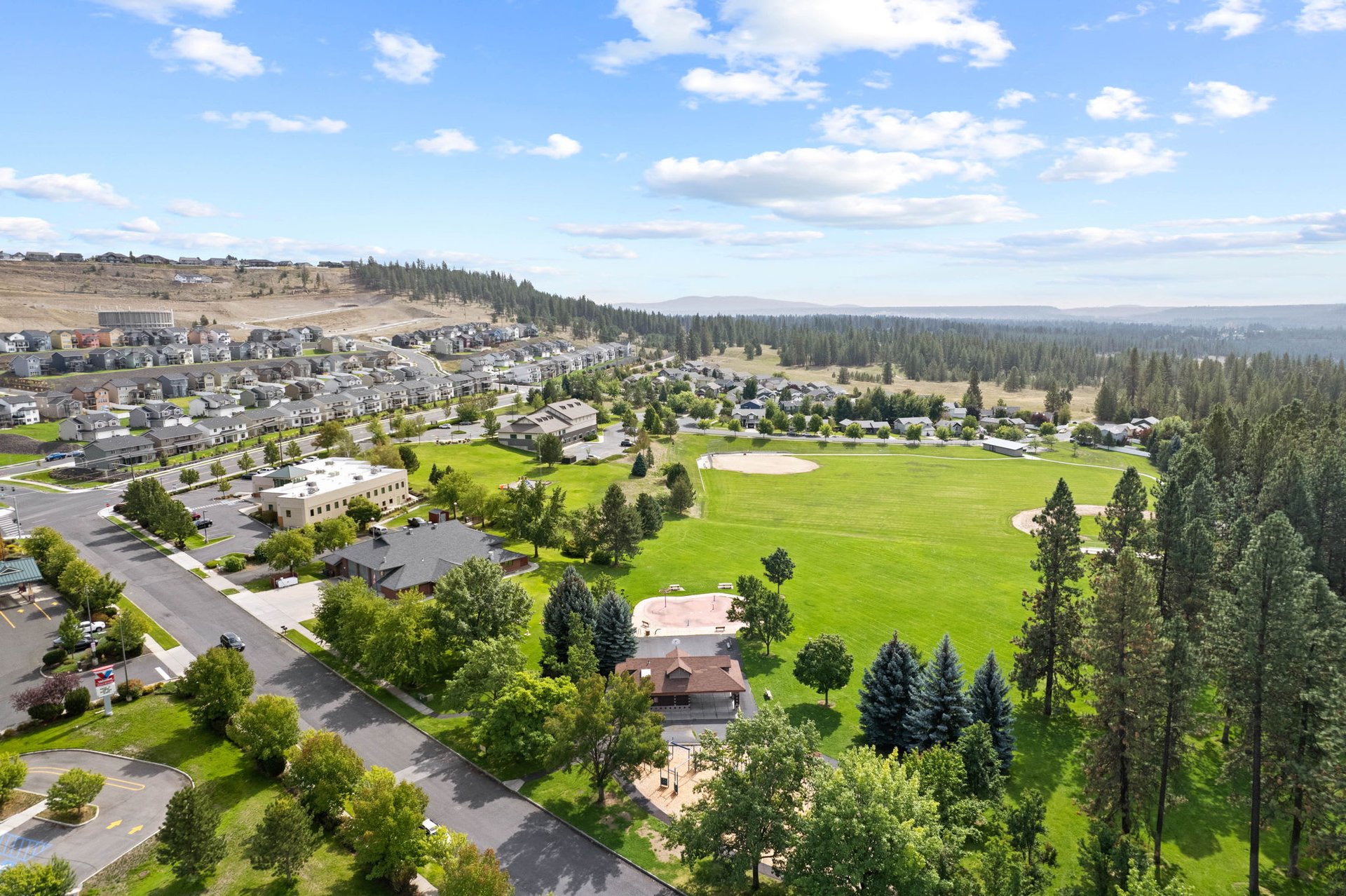
Five Mile Prairie
Situated on a plateau, Five Mile Prairie offers panoramic views and newer residential developments. It's known for its family-friendly environment.
Samara’s Picks
-
Though this area is primarily residential, the Sky Prairie Park is a wonderful, spacious city park.
Five Mile Prairie Overview
Five Mile Prairie sits dramatically atop a 400-foot-high, 3,400-acre basalt mesa that provides spectacular views of the sunrise and sunset over the city. Inhabited for centuries by the Siwash Tribe, who named it "Billymeechum" or "home of the tall grass," the area transitioned into an agricultural gem in the late 1880s where homesteaders cultivated vast fruit orchards, grains, and berries. The neighborhood was annexed into the city in stages starting in 1966. Today, Five Mile Prairie has successfully transitioned into a premier residential community that beautifully blends historic elements, like remaining family farmsteads and the historic 1912 brick Five Mile Schoolhouse, with new suburban subdivisions.
Five Mile Prairie Demographics
Five Mile Prairie has a population of approximately 4,691 residents. According to city profile estimates, the population identifies as 88.5% White, 4.8% Asian, 4.2% Latinx, 1.4% Black or African American, and 0.8% American Indian/Alaska Native. The built environment consists primarily of mid-sized to larger single-family homes, and because there are no commercial businesses directly on the prairie, residents enjoy a purely residential setting that values the outdoors.
View the Five Mile Prairie Neighborhood Map
North Hill

Delightfully crafted drinks served in the cutest, bite-size bar. Bon Bon is a treasure in North Spokane. Photo courtesy of @bonbonspokane
North Hill is a residential neighborhood with a mix of housing styles. It offers easy access to parks and shopping centers.
Samara’s Picks
-
The Garland Theater is a gem in Spokane with second-run films and fun movie events. Grab a cocktail at Bon Bon before heading into the theater.
-
Make a quick visit to the Brown Derby (one of the oldest bars in WA state) or the Mary Lou’s Milk Bottle (also around since the 1930s) for some fun times and some history!
-
Also worth a visit is the Spokane Public Library at Shadle Park, which sits on the neighborhood’s border. All the Spokane Public Libraries received huge renovations in the last 5 years making library visits that much more fun!
North Hill Overview
The North Hill neighborhood is a stable, thriving community historically defined by the Monroe Street Hill, which once marked the northern city border. The arrival of the street railway system in the early 1900s transformed the area from a forested rural landscape into a beautifully platted residential neighborhood filled with Craftsman bungalows, Tudor chalets, and two-story farmhouses. A major focal point is the Garland Avenue Business District, a unique, walkable commercial cluster featuring art-oriented shops, dining, and distinct local landmarks like the iconic 1935 Milk Bottle building and the independent Garland Theater. Residents take great pride in the neighborhood's convenient access to nature, notably its southern bluff which serves as a wildlife corridor and offers sweeping panoramic views of the Spokane skyline.
North Hill Demographics
North Hill is known as an affordable, civic-minded neighborhood populated by an easy-going mixture of single residents and families across all ages. Low-density single-family housing is the primary land-use type, allowing between four to ten units per acre, complemented by modern low-rise apartments and duplexes. The neighborhood has excellent connectivity and is anchored by long-standing public amenities, including Franklin Park and historic schools like Frances Willard Elementary, which opened in 1908.
View the North Hill Neighborhood Map
North Indian Trail
This suburban neighborhood features winding streets and newer homes. It's known for its quiet atmosphere and family-oriented community.
Samara’s Picks
-
One of my favorite restaurants falls outside this neighborhood in Spokane County, but I need to feature it here! 1898 Public House is so great - I’ve featured it here and here!
-
St. George’s Trailhead is at the northern most tip of this neighborhood and offers access to Indian Painted Rocks and the Little Spokane River.
North Indian Trail Overview
The North Indian Trail neighborhood is tucked into the far northwestern corner of the Spokane city limits, taking its name from the historic Indian Trail Road. For centuries, this path was a major thoroughfare utilized by Native Americans and early settlers to travel between the Columbia and Little Spokane rivers. The area maintained its scenic, rural character until it was annexed north of Francis Avenue in the 1950s, kicking off steady residential development that accelerated through the 1970s. Today, North Indian Trail is a highly desired community that successfully preserves its open space and natural appeal. It is served by a large commercial center at West Barnes Road, offering popular neighborhood amenities like the regional health clinic, public library, and local dining spots.
North Indian Trail Demographics
North Indian Trail features a diverse natural landscape filled with mature ponderosa pines, rolling valleys, and ridges that have beautifully dictated the layout of its modern subdivisions. The built environment consists primarily of suburban single-family homes with large yards, along with targeted developments of modern duplexes, apartments, and condominiums near its commercial core. The family-oriented community is heavily served by local schools like Woodridge Elementary, which opened in 1981.
View the North Indian Trail Neighborhood Map
Northwest
Northwest Spokane is a diverse area with a mix of residential, commercial, and industrial zones. It offers a variety of housing options.
Samara’s Picks
-
Dwight Merkel Sports Complex is a great sports complexed used by the entire city.
-
Bowl and Pitcher (Riverside State Park) access is at the western tip of this neighborhood.
-
The Annie Charles Spokane Lookout Spot is a great place to see the Spokane River below or take in a sunset.
Northwest Overview
The Northwest neighborhood is an established, casual, and highly friendly community situated along the scenic bluffs of the Spokane River. Historically, local Native American tribes used the western riverbanks for fishing and winter trading camps, traveling along a prominent thoroughfare that ran past local springs. During World War II, the neighborhood hosted the sprawling Baxter General Hospital complex, a 300-building military facility that later evolved into the Veteran's Affairs Memorial Hospital and the iconic Joe Albi Stadium. Today, the neighborhood is predominantly residential, characterized by shaded, tree-lined streets and proud homeowners. It provides unparalleled access to regional outdoor treasures like Riverside State Park, where residents can bike, hike, and explore the historic swinging bridge over the river.
Northwest Demographics
Northwest Spokane features well-built and relatively inexpensive housing that routinely attracts a stable mix of young families, working professionals, and retirees. The neighborhood contains highly rated schools, pristine green spaces like Loma Vista Park, and isolated commercial pockets centered around old trolley lines where locals find handy hardware stores, cozy cafes, and specialty bakeries. It is anchored by massive recreational hubs, including the Dwight Merkel Sports Complex, which features soccer fields, a BMX track, a skate court, and extensive perimeter trails.
View the Northwest Neighborhood Map
Peaceful Valley
Nestled along the Spokane River, Peaceful Valley is a quaint neighborhood with a mix of historic homes and new developments. It's known for its tranquility and proximity to downtown. It’s absolutely charming and feels miles away from a city, even though it’s walkable to downtown.
Samara’s Picks
-
Spruce Street Stairs (temporarily closed) takes you up from Peaceful Valley to Browne’s Addition. Walking every step up really helps you understand why Spokane Falls are so spectacular!
-
Parking at People’s Park and taking the bridge over the Spokane River up to Kendall Yards is a great longer walk with a fun destination at the end. Don’t miss the famous bike siting!
-
The Historic Cowley School Building is not available to walk through (it is now apartments), but if you’re in the neighborhood it’s worth a drive-by. It’s utterly charming.
Peaceful Valley Overview
Peaceful Valley is a uniquely secluded, historic enclave cradled by a dramatic southern basalt bluff and the banks of the flowing Spokane River. Long before European settlement, the valley was a vital traditional gathering spot where bands of the Spokane Tribe harvested salmon near the confluence of Latah Creek. Platted in the late 1800s, it grew as a working-class neighborhood built up largely by Finnish immigrants who introduced unique architectural styles, community saunas, and labor organizing. In the 1950s, the construction of the Maple Street Bridge bisected the valley, removing numerous homes but leaving behind a grandiose structure that enhances the neighborhood's sense of intimate containment. Today, it functions as a serene hidden village steps from the busy downtown core.
Peaceful Valley Demographics
Peaceful Valley is celebrated for its unpretentious, bohemian, and individualistic spirit, acting as a supportive hub for artists, musicians, and writers. Residents take deep pride in a highly inclusive community atmosphere where unique residential gardens are frequently favored over pristine lawns. The built environment presents a human-scaled, affordable mix of historic vernacular homes, modern infill houses, and hand-built basalt rock retaining walls that trace the gently sloping streets leading down to the waterfront.
View the Peaceful Valley Neighborhood Map
West Central
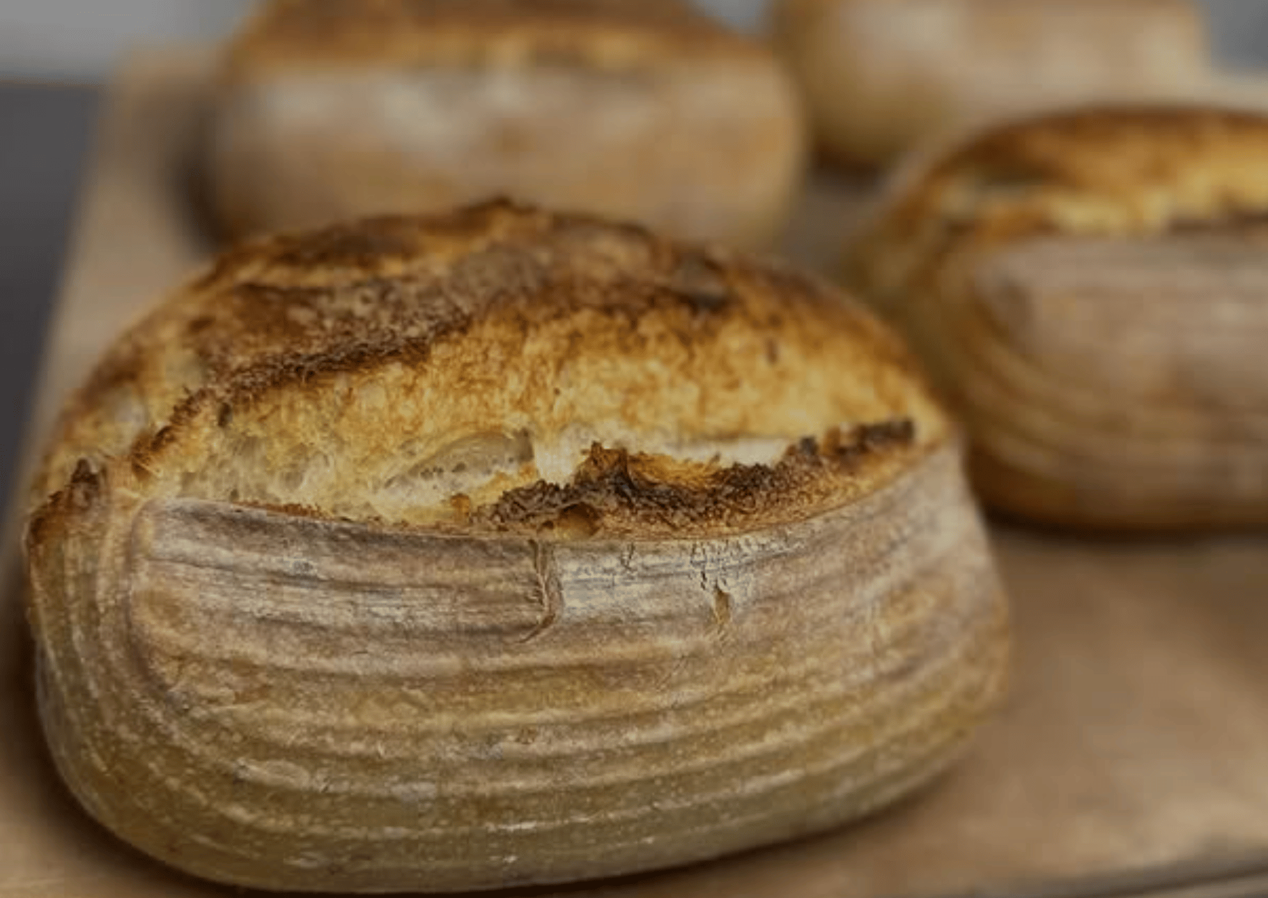
From sourdough to produce to handmade goods, the Night Market has something for everyone. Photo courtesy of @kendall_yards_night_market
West Central is undergoing revitalization and includes the Kendall Yards development. It's a diverse neighborhood with a mix of residential and commercial areas.
Samara’s Picks
-
Maryhill Winery in Kendall Yards is a great stop with a view!
-
The Centennial Trail through this neighborhood is one of the most interesting stretches of the trail.
-
I’ve talked about the Kendall Yards Night Market before. It’s a great evening outing or date night.
West Central Overview
West Central is one of Spokane's oldest inner-city neighborhoods, situated on a high, level plain that slopes gently down to the banks of the surrounding Spokane River. First homesteaded as a rugged wilderness by Colonel Jenkins in 1879, visionary local developers like William Nettleton and Hiram Muzzy platted hundreds of city lots by the late 1880s, transforming the area into a booming middle-class suburb. For decades, the neighborhood thrived as an economic center, incorporating railroad routes, a historic amusement park at the Boone Avenue line terminus, and a dense variety of neighborhood shops. Today, West Central serves as a highly valuable community asset, conveniently located blocks from the Central Business District and anchored by striking historic landmarks like the Spokane County Courthouse.
West Central Demographics
West Central is celebrated for its remarkable architectural diversity, featuring historic housing stock that includes Queen Anne-Victorian, Craftsman, Bungalow, and Cottage styles. A significant section of the neighborhood is protected within the Nettleton Historic District, where residents work alongside city planners to encourage architecturally complementary development. Modern design initiatives focus on preserving this historic flavor while improving walkability, infrastructure, and expanding everyday local services for its socially diverse resident base.
View the West Central Neighborhood Map
Wow - that’s a lot, and we’ve only covered one third of the beautiful neighborhoods in Spokane, WA. Each of Spokane's neighborhoods offers its own unique charm and community spirit. Whether you're looking for historic architecture, scenic views, or a vibrant community, Spokane's neighborhoods have something to offer you!
For more detailed information on each neighborhood, you can visit the City of Spokane's Neighborhood Councils page here. If you’re looking for more insider perspective about placing roots in Spokane, get in touch with me here or view my portfolio.