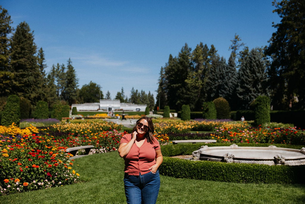
As a born and raised local to Spokane, Washington, I take great pride in offering my clients extensive knowledge of Spokane and its unique neighborhoods. As Spokane has grown, its neighborhoods have developed even more unique character and distinct micro-cultures. Knowing this information intimately helps me parse out the small details that might make one neighborhood a better fit for a family than another.
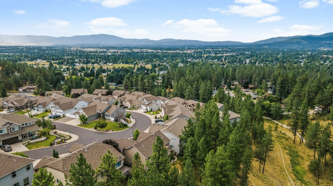
Spokane is divided into 29 officially recognized neighborhoods by the city, each with its own unique character and community. Below I will give an overview of each community with links to City of Spokane resources, as well as my “Samara’s Picks” for community spaces or businesses that are a can’t-miss in that area. These neighborhoods are organized into three districts: Northeast (District 1), South (District 2), and Northwest (District 3). Each neighborhood has a Neighborhood Council that works to maintain and improve the quality of life in the area. I’m including a link to each neighborhood council website and some additional city links that can give you more information.
This is part two of a three part series focused on the District 2 neighborhoods in South Spokane. You can view part one and part three at the respective links!
District 2: South Spokane
Cliff/Cannon
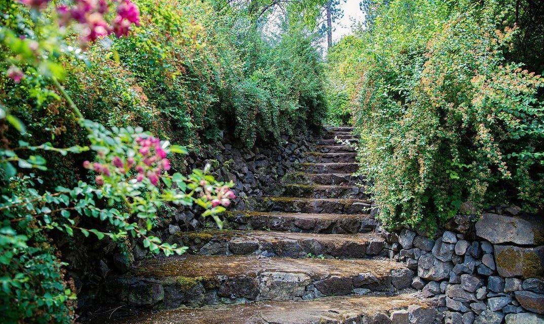
Historic rock steps at Moore-Turner Heritage Gardens. Photo by JLC Photo
This neighborhood features historic homes and is close to downtown Spokane. It's known for its charming streets and proximity to medical facilities.
Samara’s Picks
-
RUT is a great vegetarian and vegan restaurant that’s walkable in this neighborhood
-
Moore-Turner Heritage Gardens are hidden gem I’ve mentioned before in this neighborhood
-
Same with Cliff Park!
-
Huckleberries Natural Market is a Spokane staple to visit
Cliff Cannon Overview
Cliff Cannon is one of the great historic neighborhoods in central Spokane, featuring a dramatic, elevated location that rises uphill to the south of downtown. In 1874, Reverend Henry Thomas Cowley became one of the first settlers in the area, and the Spokane Tribe helped build a log cabin and schoolhouse on the land that is now Cowley Park. The northern portion of the neighborhood, Cannon's Addition, was platted in 1883 by Anthony McCue Cannon. By the late 1800s, it evolved into an elite area where bankers, senators, doctors, and entrepreneurs built grand mansions along the basalt bluff. The neighborhood's primary development occurred between 1900 and 1925, supported by streetcars that served the South Hill from 1888 to 1936. The area is rich in historic treasures, including the Moore-Turner Heritage Gardens, Edwidge Woldson Park, and Cliff Park—a 4.5-acre park centered around a 100-foot volcanic outcrop. Today, residents enjoy close proximity to downtown along with tree-lined, quiet streets. Housing choices remain diverse, featuring historic mansions, modest older homes, condominiums, and apartments. Cliff Cannon also serves as a major health care center for the region, housing Deaconess, Shriners, and Sacred Heart hospitals, alongside local schools like Roosevelt Elementary and Lewis and Clark High School.
Cliff Cannon Demographics
The Cliff Cannon neighborhood is home to a population of 8,352 residents living across 4,619 households. Only 14.7% of these households have children, and a significant 68.8% are renter-occupied. The median household income in Cliff Cannon is $33,045, which tracks lower than the Spokane citywide median of $44,768. The neighborhood has 16.8% of its residents aged 19 and under, while 12.3% are aged 65 and over. Demographically, the population identifies as 85.1% White, 5.3% Latinx, 4.4% Two or more races, 3.4% Black or African American, 3.2% Asian/Native Hawaiian/Pacific Islander, and 1.8% American Indian or Alaska Native. Foreign-born residents make up a notable portion of the community, with top countries of origin including the Philippines (16.4%), Burma (14%), Canada (9.3%), and Mexico (5.5%). Educational attainment is strong, with 42.4% holding a bachelor's degree or higher—well above the 29.5% citywide average—while 19.5% hold only a high school diploma. Within the local schools, 36.4% of students qualify for free or reduced lunch programs. The unemployment rate in Cliff Cannon stands at 6.5%. When surveyed on neighborhood priorities, residents highlighted crime, safety, and drugs, alongside roads and transport, sidewalks, jobs and the economy, and construction.
View the Cliff Cannon Neighborhood Map
Comstock
Comstock is a primarily residential neighborhood with tree-lined streets and parks. It offers a suburban feel within the city limits.
Samara’s Picks
-
This neighborhood's namesake park, Comstock Park, is worth a visit!
-
Luna is a special neighborhood restaurant that falls right outside this neighborhood in Spokane County, but is always worth a visit for a special occasion
-
Take a drive in spring, summer or fall. Start on the corner of High Drive and 29th Street, then follow High Drive south to S. Hatch Road past Manito Golf Course, and wind all the way down until you hit Hwy 195. You will quickly learn why Spokane’s South Hill is so beloved.
Comstock Overview
Comstock is an established, highly sought-after neighborhood located on Spokane's South Hill, characterized by rolling lawns, park-like stands of ponderosa pines, and predominantly mid-century architecture. Development in the area began during the streetcar era in 1888, when the Montrose Electric Company (or "Cook's Line") connected the vicinity to downtown. Early milestones included the construction of Manito Boulevard in 1907 and the establishment of the early Spokane Country Club. However, the majority of the neighborhood's residential development boomed post-World War II, bringing an influx of single-family homes. At its western edge along High Drive, the neighborhood's typical residential grid gives way to dramatic topography and expansive sunset views across the Latah Valley. Today, Comstock is known as a family-friendly, stable, and walkable community. Residents can easily access local destinations like the South Hill Library, the Manito Shopping Center, and neighborhood schools such as Jefferson Elementary and Sacajawea Middle School. Green spaces are a cornerstone of the area, featuring Comstock Park, Hart Field, and tree-lined boulevards used by cross-country skiers in the winter. The volunteer-run Comstock Neighborhood Council meets monthly at the Manito United Methodist Church, partnering with the city to organize community clean-ups, summer block parties, and traffic-calming improvements.
Comstock Demographics
The Comstock neighborhood is home to 6,615 residents living across 2,890 households, with 21.2% of these households having children. The community features a strong rate of homeownership, with only 24.6% of homes being renter-occupied—significantly lower than the citywide average of 45.3%. Economically, Comstock is relatively affluent; the median household income is $68,084, well above the Spokane median of $44,768. The neighborhood maintains a balanced age distribution, with 23.6% of residents aged 19 and under, and 19.1% aged 65 and over. Demographically, the population identifies as 91.3% White, 3.7% Latinx, 3.0% Two or more races, 2.5% Asian/Native Hawaiian/Pacific Islander, 1.3% Black or African American, and 0.7% American Indian or Alaska Native. Among its foreign-born population, the most common countries of origin are Canada (17.3%), Korea (16.2%), China (12%), and Colombia (8%). Educational attainment is exceptionally high, with 55.1% of residents holding a bachelor's degree or higher, compared to the 29.5% citywide average. In local schools, 33.4% of students qualify for free or reduced lunch programs. The neighborhood boasts a low unemployment rate of 3.8%. When surveyed on community priorities, residents most commonly focus on crime and safety, roads and transportation, homelessness, the local economy, and construction.
View the Comstock Neighborhood Map
East Central
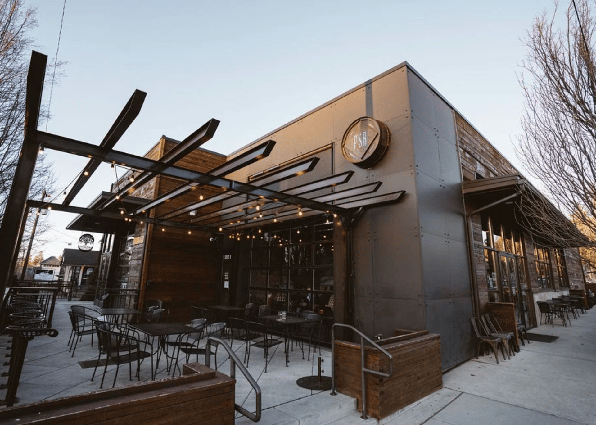
Perry Street Brewing is a great stop in East Central. Photo from Visit Spokane.
East Central is a diverse neighborhood undergoing revitalization. It includes the South Perry District, known for its local businesses and community events.
Samara’s Picks
-
Perry District falls within this neighborhood and is utterly charming. I talk about it in my Spokane Relocation Guide from a Local
-
Don’t miss Perry St. Brewing, South Perry Pizza, Liberty Park Florist or the Grain Shed.
-
The up and coming areas of East Sprague also fall within this neighborhood. Some favorites are The Tin Roof, Sonnenberg’s Market and Deli and MiFlavour Modern French Bakery.
East Central Overview
East Central is one of Spokane's oldest neighborhoods, originally developed in the late 1800s and early 1900s as a working-class suburb east of the city's downtown core. Historically known as "Union Park," the area thrived as a factory section filled with lumber and flour mills along Sprague and Trent Avenues. It attracted a diverse, hard-working population of Scandinavian, Italian, Russian, African American, French, and Polish immigrants. The neighborhood spread east from Division Street for over five miles, with Southeast Boulevard winding up the hill along what was once an old Indian trail. For decades, the area flourished as a bustling commercial and residential hub until the construction of Interstate 90 in the late 1950s. This massive project split the neighborhood in half, destroying the historic Liberty Park and hundreds of homes, and creating a physical barrier in the community.
Today, however, East Central is a community in transition and experiencing a vibrant resurgence. Attracted by the relatively low cost of living, charming historic homes, and close proximity to downtown, young families and professionals are increasingly returning to the area. Recent revitalization efforts have transformed the South Perry Business District and the East Sprague Avenue corridor, which are now bustling with trendy restaurants, breweries, and specialty shops. Residents enjoy strong community ties, local green spaces like the relocated Liberty Park, Underhill Park, and Grant Park, and lively annual events such as the South Perry Street Fair and local summer concert series. The active East Central Neighborhood Council meets monthly at the East Central Community Center to support local growth, community building, and neighborhood advocacy.
East Central Demographics
The East Central neighborhood is home to 12,126 residents living across 4,464 households. Approximately 23% of these households have children, and 48.1% of the homes are renter-occupied, which is slightly higher than the citywide average of 45.3%. Economically, East Central faces challenges, with a median household income of $38,326—trailing the Spokane citywide median of $44,768. The community has a younger demographic profile compared to the rest of the city, with 27.1% of residents aged 19 and under, and just 10.4% aged 65 and over.
It is a remarkably diverse neighborhood, with 23.3% of the population identifying as persons of color. Specifically, residents identify as 76.7% White, 7.6% Two or more races, 7.5% Latinx, 6.3% Black or African American, 5.0% Asian/Native Hawaiian/Pacific Islander, and 2.6% American Indian or Alaska Native. Among its foreign-born population, the most common countries of origin are Vietnam (11%), Russia (9%), Ukraine (8.8%), and Canada (8.4%). Educational attainment shows that 22.5% of residents hold a bachelor's degree or higher, while 25.6% possess only a high school diploma. Within local schools, such as Sheridan Elementary, an overwhelming 100% of students qualify for free or reduced lunch programs. The neighborhood's unemployment rate stands at 8.9%. When surveyed on community priorities, residents most commonly emphasized addressing crime, safety, and drugs, alongside jobs and the economy, neighborhood planning, roads and transportation, and animal-related issues.
View the East Central Neighborhood Map
Grandview/Thorpe
This area offers scenic views and a mix of residential and undeveloped land. It's characterized by its natural landscapes and proximity to downtown.
Samara’s Picks
-
This petite neighborhood is primarily residential, but that doesn’t mean it’s far away from things. Tucked up just outside west of downtown, you have 5-10 minute access to Indian Canyon Golf Course, Spokane International Airport, Downtown Spokane and more.
-
Finch Arboretum falls right outside the boundary of this neighborhood. I’ve mentioned it in my Favorite Gardens and Green Spaces.
Grandview-Thorpe Overview
Grandview-Thorpe is a quiet, wooded neighborhood set apart on the southwest edge of the city, perched above sweeping views of Spokane and the Latah Valley. Often thought of by locals as Spokane's "other South Hill," the area boasts a uniquely serene, natural feel. The neighborhood's quiet surroundings contribute to routine wildlife sightings, including deer and moose on residential streets and in backyards. Historically, the area remained sparsely populated until it was connected to downtown by the Washington Water Power Company's interurban streetcar line (the Medical Lake Railroad), which operated from 1905 to 1922. The line crossed the Latah Valley over a long wooden trestle built in 1904. Today, residents enjoy a highly residential lifestyle, typically commuting to downtown or surrounding areas for shopping and work, as there are few workplaces in the neighborhood itself. Outdoor recreation is a major draw; residents frequently exercise on the paved Fish Lake Trail or the unpaved Reimer Trolley Trail, which traces the former interurban rail line. Grandview Park serves as a favorite destination and social hub, offering a splash pad, playground, and barbecue grill where neighbors frequently gather for playdates and dinners. The Grandview-Thorpe Neighborhood Council meets quarterly to organize community activities like yard sales, block watches, and bi-annual cleanups.
Grandview-Thorpe Demographics
Grandview-Thorpe is an intimate community with a population of 1,448 residents living across 653 households. Roughly 28.2% of these households include children, and 46.5% of homes are renter-occupied, which is slightly higher than the citywide average of 45.3%. Economically, the neighborhood performs well, with a median household income of $55,491, comfortably exceeding the Spokane citywide median of $44,768. The age distribution closely mirrors the rest of the city, with 20.5% of residents aged 19 and under, and 14.3% aged 65 and over. Demographically, the population identifies as 90.2% White, 4.2% Latinx, 4.1% Two or more races, 3.0% Asian/Native Hawaiian/Pacific Islander, 1.3% Black or African American, and 0.8% American Indian or Alaska Native. Educational attainment in the neighborhood is notably high, with 41% of residents holding a bachelor's degree or higher—well above the 29.5% citywide average—while 21.3% possess only a high school diploma. The unemployment rate stands at a low 4.5%, compared to the citywide rate of 6.5%.
View the Grandview Thorpe Neighborhood Map
Latah/Hangman
Also known as Latah Valley, this neighborhood features a mix of rural and suburban living. It's known for its natural beauty and open spaces.
Samara’s Picks
-
The Creek at Qualchan Golf Course is a fabulous city course that is worth a visit!
-
The Eagle Ridge Community falls within this neighborhood. I’ve highlighted this community hilltop neighborhood and also have a neighborhood guide.
-
Chaps Diner and Bakery is a can’t-miss Spokane Restaurant. Try the baked oatmeal, you won’t regret it!
Latah/Hangman Overview
Latah/Hangman is a large and geographically distinct neighborhood in Spokane, defined by the deep valley cut by Latah Creek (also known locally as Hangman Creek). Stretching from the Spokane River Gorge in the north to the city's southernmost limit, the neighborhood is somewhat isolated from the rest of the city, giving it a unique, small-town feel despite its proximity to downtown. The creek and U.S. Route 195 divide the valley into distinct districts, including Vinegar Flats, Qualchan, and Eagle Ridge. The area carries deep historical significance; the confluence of Latah Creek and the Spokane River was an important traditional gathering and fishing site for Native Americans for thousands of years. The creek's dual names reflect this history: "Latah" stems from a Nez Perce word meaning "fish" or "a place of pines," while "Hangman" refers to the tragic hanging of Palouse Indians by Colonel George Wright during the 1858 Yakima War. Over the decades, the valley has served as a major transportation corridor, and its historic High Bridge Park has hosted everything from early automotive tourist camps to military housing during World War II and transient encampments during Expo '74. Today, the neighborhood offers a scenic blend of residential developments nestled alongside expansive rural and undeveloped areas. Residents enjoy access to abundant green spaces, wildlife, and mature ponderosa pines.
Latah/Hangman Demographics
The Latah/Hangman neighborhood is home to 4,938 residents living across 2,068 households, with 27.8% of these households having children. The community features a very strong rate of homeownership, with only 16% of homes being renter-occupied—substantially lower than the citywide average of 45.3%. Economically, the neighborhood is relatively affluent; the median household income is $66,535, well above the Spokane median of $44,768. Demographically, the population identifies as 92.2% White, 4% Latinx, 2.1% Asian/Native Hawaiian/Pacific Islander, 1.1% Black or African American, and 0.9% American Indian or Alaska Native. Approximately 91.8% of residents were born in the United States; among the foreign-born population, the most common countries of origin are Ukraine (15.9%), Russia (11.9%), the United Kingdom (10.2%), and Mexico (9%). Educational attainment in the neighborhood is notably high, with 44.6% of residents holding a bachelor's degree or higher, compared to the 29.5% citywide average, while 17% possess only a high school diploma. The unemployment rate stands at a low 4.5%, outperforming the citywide rate of 6.5%.
View the Latah/Hangman Neighborhood Map
Lincoln Heights
Lincoln Heights is a well-established neighborhood with shopping centers, parks, and schools. It offers a balance of residential and commercial areas.
Samara’s Picks
-
Two Seven Public House is a great pub in a locally owned restaurant group
-
Haase’s Greenhouse has some of the healthiest annuals and widest selection of Coleus I’ve seen locally. They are a fun visit!
-
Upper Lincoln Park is another great, historic park to visit!
Lincoln Heights Overview
Lincoln Heights is a large and diverse neighborhood located on Spokane's South Hill. Inhabited by the Spokane people for centuries, the area saw its first modern development in 1885 when 29th Avenue was established as an east-west county road. Following the Great Spokane Fire of 1889, streetcar lines were extended into the neighborhood to spur suburban growth. The area's development was heavily influenced by the famed Olmsted Brothers, who recommended the creation of a large park, and prominent local philanthropists Levi and May Arkwright Hutton, who realized that vision by donating 31 acres in 1912 to establish what is now Lincoln Park. Another major landowner, Charles F. Adams Jr.—grandson of the sixth U.S. President—helped open the eastern edge of the neighborhood for development.
For decades, the area maintained a semi-rural character before seeing massive residential infill development in the 1970s and 1980s. Today, Lincoln Heights features a unique blend of early 1900s Craftsman homes in its older northern sections near Altamont Hill, transitioning into mid-century ranchers and newer split-levels further south and east. It is anchored by a bustling commercial district along 29th Avenue, centered around the Lincoln Heights Shopping Center which was originally built in the 1950s. Residents enjoy an abundance of natural features, including mature pine trees, wetlands, and dramatic rock outcrops in Lincoln Park. The neighborhood is home to five properties on the National Register of Historic Places (including the historic Hutton House and Franklin Elementary) and boasts active community engagement through the Lincoln Heights Neighborhood Council.
Lincoln Heights Demographics
The Lincoln Heights neighborhood is home to approximately 14,272 residents living across 6,364 households. The community features a mix of housing options, though it remains primarily owner-occupied. It maintains a solid family presence, with 25.8% of its residents aged 19 and under.
Demographically, the population identifies as 86.4% White, 5.8% Two or more races, 3.3% Black or African American, 3.0% Latinx, and 1.2% Asian/Native Hawaiian/Pacific Islander. While the vast majority of the neighborhood (91.5%) was born in the U.S., Lincoln Heights features a distinct foreign-born population, with the most common countries of origin being Ukraine (15.4%), Russia (14.5%), Moldova (13.8%), and Vietnam (7.3%). When surveyed on community priorities, residents most commonly emphasize roads and transportation, addressing crime, safety, and drugs, alongside schools, neighbor relations, and the local economy.
View the Lincoln Heights Neighborhood Map
Manito/Cannon Hill
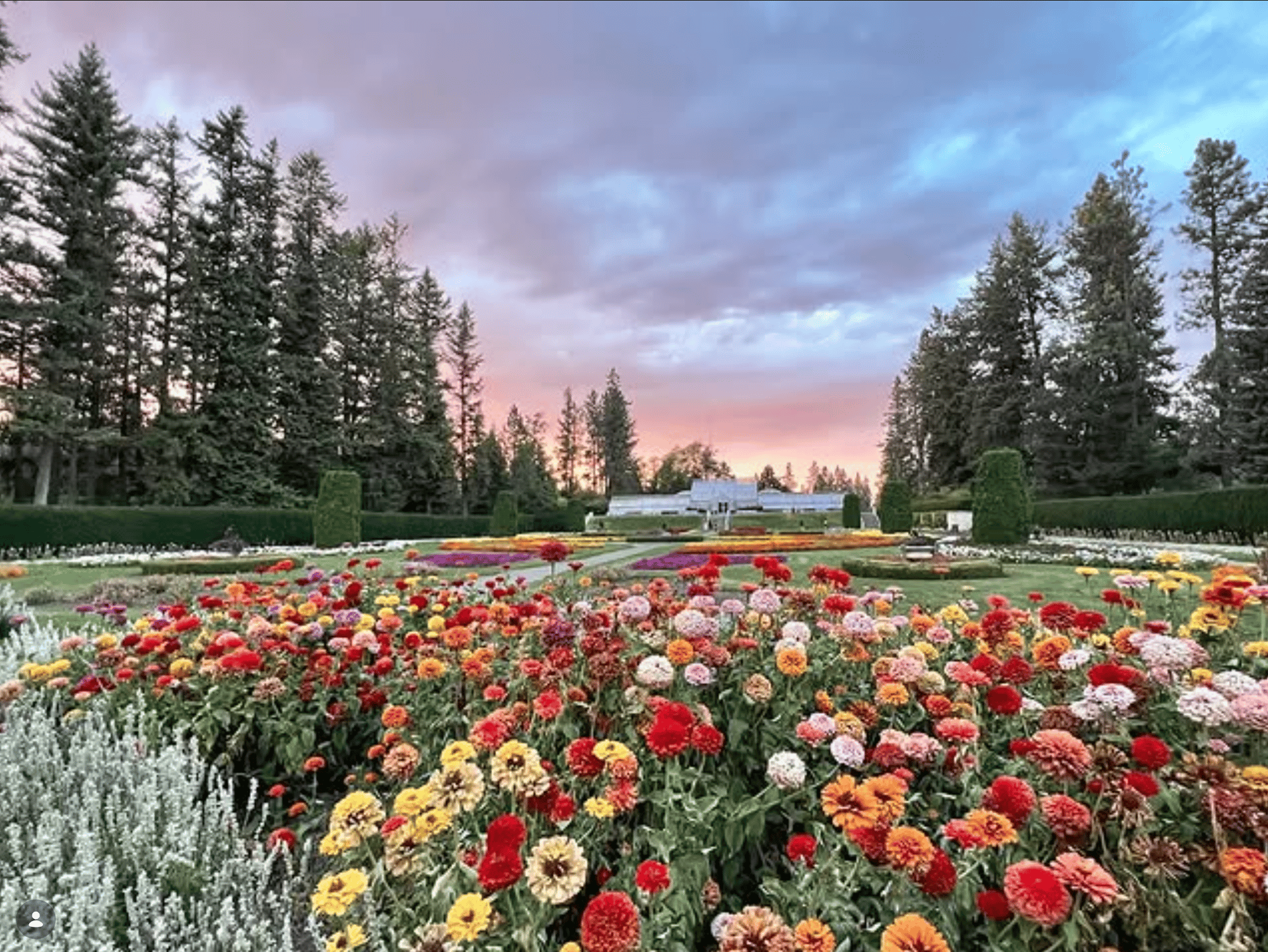
I've mentioned Manito Park on my blog many times before for good reason! Check it out if you haven't. Photo courtesy of @thefriendsofmanito
This neighborhood is known for its historic homes and proximity to Manito Park. It offers a picturesque setting with tree-lined streets.
Samara’s Picks
-
Manito Park, which I’ve featured many times before like here, here and here.
-
The Scoop for great local ice cream.
-
Cannon Hill Park, too!
-
Wilson Elementary falls within this neighborhood.
Manito/Cannon Hill Overview
The Manito/Cannon Hill neighborhood is a classic, well-designed historic community located on Spokane's South Hill. Development in the area was spurred by the introduction of streetcar lines between 1888 and 1936, alongside the creation of major parks and tree-lined boulevards. In the 1880s, the land that is now Cannon Hill Park was home to a clay deposit and brickyard. Once the clay was harvested, the famed Olmsted Brothers designed a park dedicated to "quiet recreation" on the site, which was eventually named after local banker and real estate developer A.M. Cannon. To the east, developer Francis Cook purchased 160 acres to create Montrose Park, which later became the beloved Manito Park. Today, Manito Park and Manito Boulevard are both listed on the National Register of Historic Places.
The neighborhood is celebrated for its mid-sized early twentieth-century homes laid out on short grid streets, many featuring distinctive facades and native ponderosa pines scattered throughout the yards. Residents enjoy a highly walkable environment with popular local hangouts like The Scoop ice cream shop, Rocket Bakery, and the "Park Bench" café located inside Manito Park. The community fosters close ties with regular yard sales, block parties, and "little free libraries" along the sidewalks. The volunteer-led neighborhood council, which meets quarterly at Wilson Elementary School, actively partners with the city to organize cleanup events and maintain the area's high quality of life.
Manito/Cannon Hill Demographics
The Manito/Cannon Hill neighborhood is home to 4,867 residents living across 2,008 households. A notable 31.8% of these households have children, and the community features a very strong rate of homeownership, with only 16.3% of homes being renter-occupied—substantially lower than the citywide average of 45.3%. Economically, the neighborhood is affluent; the median household income is $79,875, well above the Spokane median of $44,768. The neighborhood maintains a balanced age distribution, with 24.4% of residents aged 19 and under, and 16.6% aged 65 and over.
Demographically, the population identifies as 93.7% White, 3.5% Latinx, 3.3% Two or more races, 1.1% Asian/Native Hawaiian/Pacific Islander, 1.0% Black or African American, and 0.4% American Indian or Alaska Native. While 94% of the neighborhood is U.S.-born, the foreign-born population most commonly originates from Canada (29.4%), the U.K. (14.6%), Poland (11.5%), and Romania (11.5%). Educational attainment is exceptionally high, with 66.2% of residents holding a bachelor's degree or higher, compared to the 29.5% citywide average, while just 8% possess only a high school diploma. Within local schools, only 16.4% of students qualify for free or reduced lunch programs. The unemployment rate stands at a low 4.2%. When surveyed on community priorities, residents most commonly focus on crime, safety, and drugs, alongside roads and transportation, community building, access to services, and local schools.
View the Manito/Cannon Hill Neighborhood Map
Rockwood
Rockwood features historic architecture and was part of the Olmsted Brothers' master plan for Spokane. It's characterized by curving streets and mature trees.
Samara’s Picks
-
One of my favorite things about this neighborhood is that many of the streets are not in line. You could spend hours meandering through them, stumbling upon little triangular micro-parks found in spaces where the streets don’t quite line up.
-
Hutton Elementary falls within this neighborhood.
-
There is also an unnamed pond around 27th and Perry St. That I’ve always wondered about. If anyone knows the history of this, reach out!
Rockwood Overview
Located on the south side of the city to the southeast of downtown, Rockwood is one of Spokane's older and more affluent residential neighborhoods. In the 1880s, the area was originally known as "Montrose" due to its hilly terrain and patches of wild roses. Francis Cook, an early European settler and prominent developer, acquired much of the land and established a streetcar line. After he was forced to sell his holdings during the Panic of 1893, mining magnate Jay P. Graves acquired the land and extended the streetcar service.
In 1907, the famed Olmsted Brothers landscape architecture firm was hired to plan and design the neighborhood. They designed curving, diagonal streets—such as Southeast Boulevard—that wind around exposed basalt outcroppings and through ponderosa pine and Douglas fir forests. The area developed into a highly desirable residential neighborhood, featuring Tudor Revival, Colonial Revival, and large homes set well back from tree-lined streets. Much of this area is now preserved as the Rockwood Historic District and is listed on the National Register of Historic Places.
Key landmarks in the neighborhood include Hutton Elementary School, built in 1920 in a Spanish eclectic style, and the iconic Cathedral of St. John the Evangelist, a 180-foot-tall Gothic Revival structure built of cut stone that sits on a prominent bluff overlooking the city. While Rockwood borders Manito Park and Lincoln Park, it also contains smaller, unique green spaces within its boundaries, such as the grassy Olmsted Triangle Parks.
Rockwood Demographics
The Rockwood neighborhood is home to 4,337 residents living across 1,855 households. The community maintains a strong family presence, with 27.9% of households having children, and 31.5% of its residents aged 19 and under. The neighborhood features a high rate of homeownership, with only 25.8% of homes being renter-occupied—substantially lower than the citywide average of 45.3%. Economically, Rockwood is very affluent; the median household income is $87,201, nearly double the Spokane median of $44,768.
Demographically, the population identifies as 92.7% White, 3.7% Latinx, 2.8% Two or more races, 1.8% Asian/Native Hawaiian/Pacific Islander, 1.1% American Indian or Alaska Native, and 0.8% Black or African American. Among its foreign-born population, the most common countries of origin are Canada (25.6%), the Philippines (11%), Ukraine (9.8%), and Hungary (7.6%). Educational attainment in the neighborhood is exceptionally high, with 67.5% of residents holding a bachelor's degree or higher, compared to the 29.5% citywide average, while just 8.2% possess only a high school diploma. Within local schools, only 18.0% of students qualify for free or reduced lunch programs. The unemployment rate stands at a very low 2.1%. When surveyed on community priorities, residents most commonly emphasize crime, safety, and drugs, alongside jobs and the economy, roads and transportation, neighbor relations, and neighborhood planning.
View the Rockwood Neighborhood Map
Southgate
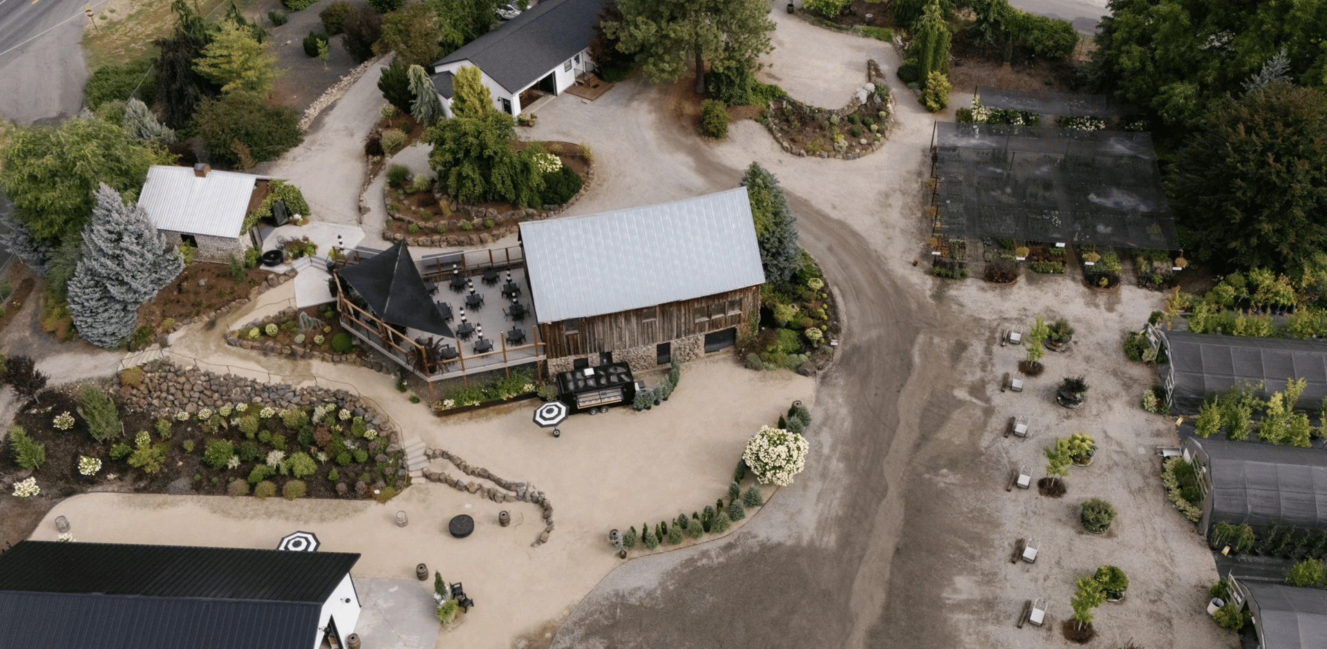
Just outside the boundary of this technical neighborhood, Barn & Blossom is a can't miss. Photo from Barn & Blossom Nursery
Located in the southeastern part of Spokane, Southgate is experiencing growth with new residential developments and commercial areas. It's home to Ferris High School and several television stations
Samara’s Picks
-
Ferrante’s Italian Cafe is a great stop for casual Italian food, gelato and a small wine and gift shop.
-
The intersection of S. Regal St and the S Palouse Hwy is a great jumping off point for a lovely drive. I love to follow it south through Valleyford and Freeman, then take Elder Road east as a slightly longer, but more scenic route to Coeur d’Alene!
-
Barn and Blossom is just south of this neighborhood within Spokane County and is the cutest nursery. They have coffee, too!
Southgate Overview
Southgate is a neighborhood in the southwestern corner of Spokane, located in the broader area known locally as the South Hill. What is now Southgate has been inhabited by the Spokane people for centuries and was historically used as a natural travel route between Latah Creek and the Spokane River. In 1859 and 1860, the Mullan Road was constructed through the area near present-day Havana Street, serving as a main route for travelers and providing early access to white settlers. Homesteading began with Joe Jackson, who established a supply stop for prospectors, and the land was later sold to French-Canadian rancher Joseph Morin around 1870. After Morin's death in 1889, John J. Browne acquired the farm; today, Moran Prairie and nearby Browne's Mountain reflect the names of these early residents.
The neighborhood saw a boost in development when the electrified Spokane and Inland Empire Railroad arrived in 1908, serving the Pine Grove Station at 37th Avenue and Havana Street until 1939. This railway accommodated the growth of fruit orchards, which later transitioned into greenhouse and chicken farming during the 1940s and 1950s. Eventually, agriculture gave way to the residential and commercial development that defined Southgate's post-World War II housing boom. Today, Southgate leans mid-century and suburban, balancing convenience to downtown with everyday shopping and amenities. It features a mix of single-family homes, multi-family units, and bustling commercial hubs—including recent additions like a Target and a Home Depot. The community also offers excellent access to local schools, such as Ferris High School, and green spaces like Hamblen Park, the Southside Sports Complex, and the Ben Burr Trail, which was built on the former railroad bed.
Southgate Demographics
The Southgate neighborhood is home to 9,700 residents living across 4,140 households, with 26.5% of those households having children. The area features a solid rate of homeownership, with 39% of homes being renter-occupied—lower than the Spokane citywide average of 45.3%. Economically, the neighborhood performs very well, boasting a median household income of $69,572, which is substantially higher than the citywide median of $44,768. The community's age distribution shows 24% of residents are aged 19 and under, while 19.7% are aged 65 and over.
Demographically, the population identifies as 89.3% White, 4.6% Two or more races, 3.6% Black or African American, 2.0% Latinx, and 0.7% Asian/Native Hawaiian/Pacific Islander. Among its foreign-born population, the most common countries of origin are Vietnam (9.7%), the United Kingdom (7.6%), Germany (7.3%), and Canada (6.9%). Educational attainment in the area is notably high, with 52.6% of residents holding a bachelor's degree or higher, compared to the 29.5% citywide average, while 13.7% possess only a high school diploma. Within local schools, 38.6% of students qualify for free or reduced lunch programs. The unemployment rate in Southgate stands at a very low 3.7%. When surveyed on community priorities, residents highlighted roads and transportation, crime, safety, and drugs, alongside neighborhood planning, rental properties, and the local economy.
View the Southgate Neighborhood Map
West Hills
West Hills offers a mix of residential areas and natural landscapes. It's known for its rolling hills and scenic views.
Samara’s Picks
-
The High Bridge Disc Golf course offers unique scenery under a historic, tall bridge
-
Palisades/Rimrock/Indian Canyon Conservation Area are great for hiking and walking. I’ve mentioned this area before in my 10 Best Hikes and Walks Close to Spokane.
-
The Bloomsday course takes you through the easternmost tip of this neighborhood!
West Hills Overview
West Hills is a diverse and established neighborhood located on the hillsides west of downtown Spokane, extending out toward the West Plains. The area boasts a rich history, beginning with the Spokane Tribe, who historically camped near Garden Springs Creek for its water and proximity to Spokane Falls. The Indian Canyon area was also a prominent Native American gathering place, and it was there that Chief Spokane Garry died in 1892. By the 1880s, Chinese gardeners were utilizing the land along the creek for planting vegetables. Development accelerated with the construction of the Fort George Wright army post in 1897 and the expansion of streetcar lines into the area. In 1913, the famed Olmsted brothers praised Fort George Wright as the "most beautiful army post in the west" and called Indian Canyon Park the most picturesque in the city's park system. That same year saw the acquisition of land for Finch Arboretum and the completion of the Latah Creek Bridge.
The commissioning of U.S. 10 (Sunset Highway) in 1926 brought a surge of commercial development, motels, and diners to serve motorists. High Bridge Park hosted a popular tourist campground from the 1920s to the 1950s, which later provided federal public housing for military families during World War II and experienced a brief revival during Expo '74. Today, West Hills offers a friendly atmosphere that attracts a diverse group of professionals, artists, families, and retirees. Residents enjoy outdoor recreation with access to the Spokane River, bluffs, basalt rocks, Finch Arboretum, and the Indian Canyon Golf Course.
West Hills Demographics
The West Hills neighborhood is home to 3,690 residents living across 1,708 households. Approximately 18.1% of these households have children, and 58.8% of the homes are renter-occupied, which tracks higher than the Spokane citywide average of 45.3%. Economically, the neighborhood performs well, boasting a median household income of $46,458, which is slightly higher than the citywide median of $44,768. The community's age distribution shows that 20.4% of residents are aged 19 and under, while 17.9% are aged 65 and over.
Demographically, 15.1% of the population identifies as persons of color. Residents identify as 84.2% White, 6.1% Latinx, 4.6% Two or more races, 4.1% Asian, 2.7% Black or African American, and 2.6% American Indian or Alaska Native. While the vast majority of the neighborhood (89.4%) was born in the U.S. or its territories, West Hills features a distinct foreign-born population, with the most common countries of origin being Mexico (13.9%), Iraq (13.4%), Saudi Arabia (9.6%), and Canada (5.9%). Educational attainment in the area is strong, with 34.9% of residents holding a bachelor's degree or higher—above the 29.5% citywide average—while 20.8% possess only a high school diploma. Within local schools, 28.7% of students qualify for free or reduced lunch programs. The unemployment rate in West Hills stands at a low 3.6%.
View the West Hills Neighborhood Map
Wow - that’s a lot, and we’ve only covered one third of the beautiful neighborhoods in Spokane, WA. Each of Spokane's neighborhoods offers its own unique charm and community spirit. Whether you're looking for historic architecture, scenic views, or a vibrant community, Spokane's neighborhoods have something to offer you!
For more detailed information on each neighborhood, you can visit the City of Spokane's Neighborhood Councils page here. If you’re looking for more insider perspective about placing roots in Spokane, get in touch with me here or view my portfolio.