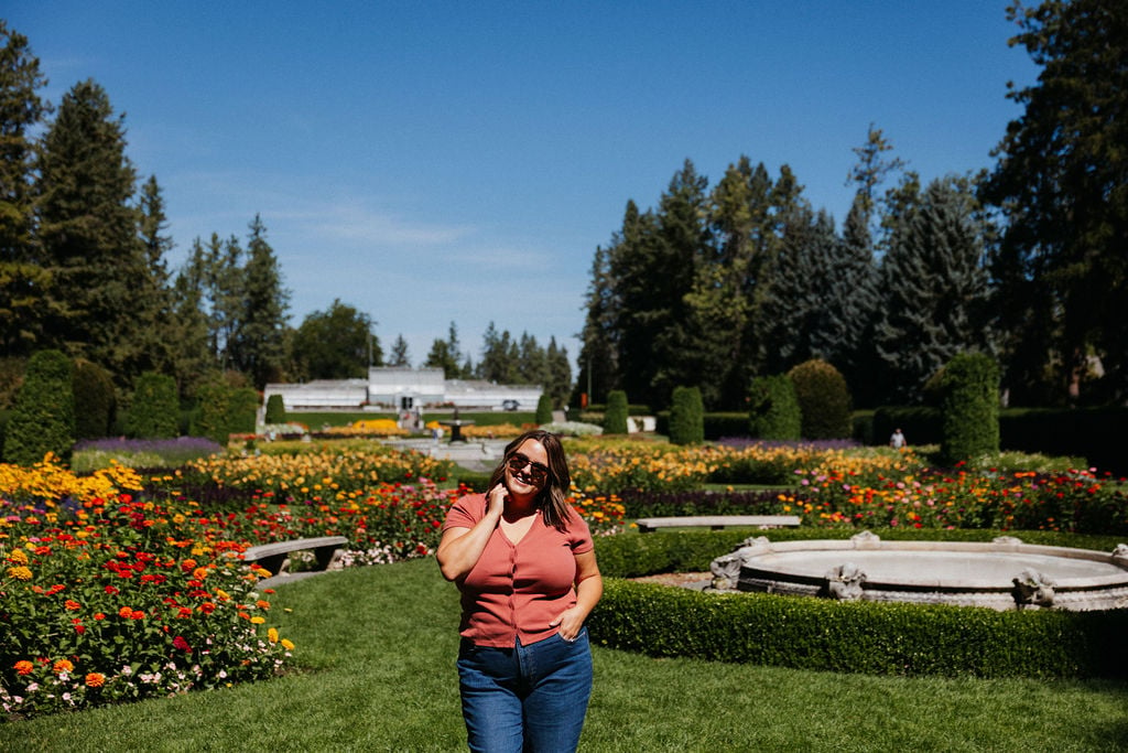
As a born and raised local to Spokane, Washington, I take great pride in offering my clients extensive knowledge of Spokane and its unique neighborhoods. As Spokane has grown, its neighborhoods have developed even more unique character and distinct micro-cultures. Knowing this information intimately helps me parse out the small details that might make one neighborhood a better fit for a family than another.
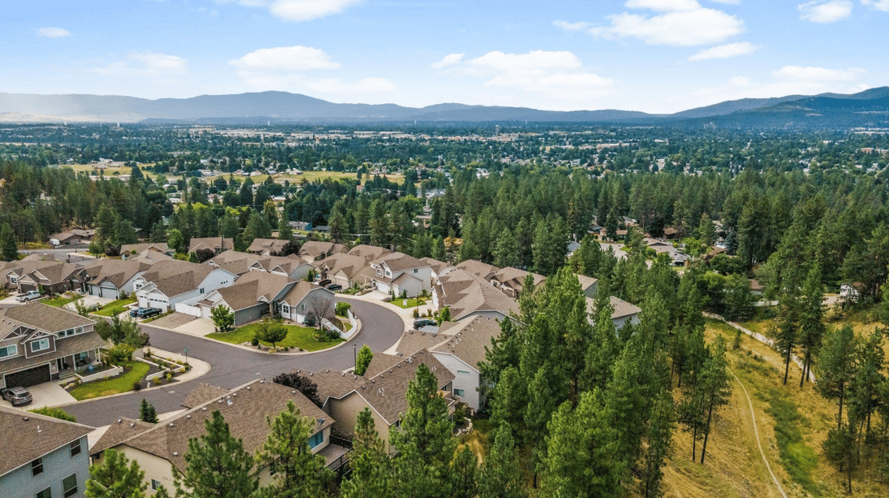
Spokane is divided into 29 officially recognized neighborhoods by the city, each with its own unique character and community. Below I will give an overview of each community with links to City of Spokane resources, as well as my “Samara’s Picks” for community spaces or businesses that are a can’t-miss in that area. These neighborhoods are organized into three districts: Northeast (District 1), South (District 2), and Northwest (District 3). Each neighborhood has a Neighborhood Council that works to maintain and improve the quality of life in the area. I’m including a link to each neighborhood council website and some additional city links that can give you more information.
This is part one of a three part series focused on the District 1 neighborhoods in Northeast Spokane. You can view part two and part three at the respective links!
District 1: Northeast Spokane
Bemiss | Spokane Neighborhood
Located in the northeast part of Spokane, Bemiss is a primarily residential neighborhood with a mix of single-family homes and apartment complexes. It features several parks and schools, making it a family-friendly area.
Samara’s Pick
-
Hay’s Park is a long, skinny stretch of green space that feels very East Coast to me.
-
Roger’s High School has art deco vibes that’s worth a drive-by, if nothing else!
-
This neighborhood is adjacent to the growing Hillyard, neighborhood. Find more business highlights in that section below.
Bemiss Overview
Bemiss, located in Northeast Spokane, boasts deep historical roots tied to both the city of Spokane and the former Town of Hillyard, which was incorporated in 1907 and annexed by Spokane in 1924. Development of early residential areas like Hays Park and Arlington Heights began in the late 1800s, driven by electric and steam-powered streetcars that connected Bemiss to downtown and the emerging Hillyard area. Public education has long been a community cornerstone, highlighted by the historic John R. Rogers High School, an Art Deco landmark built in 1932. Today, Bemiss maintains a strong blue-collar identity and neighborly spirit, characterized by early 20th-century Craftsman homes and bungalows that are often passed down or shared by longtime and newer residents alike. The neighborhood is supported by major employers like Jubilant HollisterStier, Comcast, and Sonderen Packaging, and stays connected via local bus routes. Residents are served by community hubs including the Hillyard Library and the Northeast Community Center. Families frequent three main parks: Hays Park with its peaceful arboretum, Courtland Park's baseball fields and BBQ areas, and Andrew Rypien Field, an inclusive sports complex and community garden built on a reclaimed junkyard. With views of the Spokane River Valley and a rich history of railroads, coal yards, and mid-century sledding on Napa Hill, Bemiss proudly blends its vibrant past with its close-knit present.
Bemiss Demographics
The Bemiss neighborhood is home to approximately 8,600 residents living in over 3,200 households, with nearly half of these households functioning as rentals. The community is notably younger, with almost 30% of its population under the age of 20. Economically, the area faces some challenges, featuring a median household income of roughly $34,500 and a higher-than-average unemployment rate of 10.3%. Within the local schools, nearly 75% of students qualify for free or reduced lunch programs. Demographically, the neighborhood is predominantly White, but also includes diverse populations of Hispanic, Black, Asian, Native American, and multiracial residents. Bemiss holds a notable foreign-born population as well, with many residents hailing from Ukraine, Mexico, and Belarus. The neighborhood council, which gathers monthly at the Northeast Community Center, advocates for the community by focusing on local priorities that include improving job opportunities, enhancing safety, upgrading transportation infrastructure, and elevating the community's overall appearance.
Neighborhood Links:
View the Bemiss Neighborhood Map


Chief Garry Park | Spokane Neighborhood
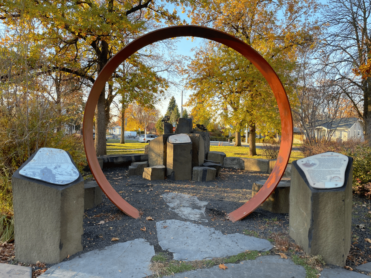
Chief Garry Park and the Spokane Tribal Gathering Place monument are the center of this neighborhood. Image from Wikipedia.
Named after Chief Spokane Garry, this neighborhood is one of Spokane's oldest. It includes the city's oldest home, built in 1879 by U.S. District Court Judge Lucias B. Nash. The area is a mix of residential and commercial properties.
Samara’s Pick
- Chief Garry Park is the namesake park that centers the neighborhood.
-
Spokane Community College falls within this neighborhood.
-
Skyway Cafe - Though temporarily closed, the owner plans to reopen this gem on Felt’s Field. It’s such a great outing, especially with kids!
-
Vien Dong Vietnamese and Chinese is a casual and beloved restaurant that’s been in the neighborhood for ages.
Chief Garry Park Overview
Chief Garry Park is one of Spokane’s oldest neighborhoods, distinguished by its historic charm and notably serving as the site of the city’s oldest house, built in 1886 by U.S. District Judge Lucias B. Nash. The area experienced rapid growth between 1900 and 1930, bringing an influx of homes, streetcar lines connecting it to downtown, and public schools like Stevens Elementary. The neighborhood's eastern edge, known as Parkwater, became home to Parkwater School and Felts Field—one of the nation’s first municipal airports, named after Lt. James Buell Felts. The neighborhood's namesake park was established in 1912 and officially dedicated in 1932. Post-WWII development introduced new housing and local businesses, including Cassano’s Italian Deli, which remains a beloved community staple today. The founding of Spokane Community College in the 1960s brought a youthful energy to the area that persists today. Currently, Chief Garry Park features a mix of single- and multi-family homes alongside light industrial zones, small commercial areas, and key city facilities. Residents actively participate in neighborhood revitalization through beautification projects, park upgrades, and community-building events like "Night Out Against Crime," all while enjoying local amenities like riverfront trails.
Chief Garry Park Demographics
Chief Garry Park is home to approximately 8,400 residents living across more than 3,600 households. About 45% of these homes are renter-occupied, ensuring accessible housing options within the community. The neighborhood boasts a diverse population, with roughly 28% of residents identifying as non-white or multiracial. It also has a notably younger demographic profile compared to the rest of Spokane, with more than a quarter of the residents under the age of 18. Economically, the area faces some challenges; household incomes generally track lower than the citywide average, and about 26% of residents live below the poverty line. Despite these financial hurdles, Chief Garry Park remains a lively and dynamic neighborhood defined by its youthful energy and strong, involved community spirit.
Neighborhood Links:
View the Chief Garry Park Neighborhood Map
Whitman | Spokane Neighborhood
Whitman is a residential neighborhood with a mix of housing options. It offers a quiet environment with access to schools and parks.
Samara’s Picks
-
Whitman is so petite and residential, there is not much to mention here. But check out Nevada Heights and Hillyard for more information on lots to do in that general area!
Whitman Overview
The Whitman Neighborhood, located in Northeast Spokane, is a highly engaged and volunteer-driven community. According to the neighborhood council's website, residents actively partner with the City to improve their quality of life through annual initiatives like neighborhood clean-ups, community engagement picnics, and traffic-calming measures such as asphalt art and mobile speed feedback trailers. Geographically, the neighborhood is bounded by Francis Avenue to the north, Crestline Street to the east, Wellesley Avenue to the south, and Perry Street to the west, sharing borders with Hillyard, Bemiss, Nevada Heights, and Shiloh Hills. The land was inhabited by the Spokane Tribe for hundreds of years before the area was officially annexed into the city of Spokane in 1907. Today, Whitman is a largely residential area anchored by Whitman Elementary School. The community benefits from strong regional ties; for the purpose of neighborhood planning, Whitman joins the adjacent Bemiss and Hillyard neighborhoods to form a planning alliance. They regularly meet together to address their shared location, culture, history, and goals for the future.
Whitman Demographics
Whitman is home to 3,741 residents living across 1,397 households, with 33.3% of these households having children. The neighborhood has a renter rate of 38.7%, which is lower than the citywide average of 45.3%. The median household income in Whitman is $41,156, tracking slightly behind the Spokane overall median of $44,768. The neighborhood has a significantly higher proportion of youth, with 28.9% of residents aged 19 or younger, while those aged 65 and over make up just 11.1% of the population. Demographically, the population identifies as 80.9% White, 7.1% Latinx, 5.6% Two or more races, 4.4% Asian/Native Hawaiian/Pacific Islander, 3.3% American Indian/Alaska Native, and 2.9% Black or African American. Approximately 93.7% of residents were born in the United States; among the foreign-born population, the most common countries of origin are Vietnam (30.2%), Ukraine (24.7%), the Philippines (19.4%), and Uzbekistan (9.6%). Educational attainment shows 40.6% of residents holding at most a high school diploma, while 9.9% possess a bachelor's degree or higher. In local schools, 79.6% of students qualify for free or reduced lunch, which is notably higher than the 54.5% citywide average. The neighborhood's unemployment rate stands at 8.8%, compared to the city's 6.5% rate. When surveyed on neighborhood priorities, residents most commonly focus on crime and safety, jobs and the economy, roads and transportation, rental properties, and neighbors.
Neighborhood Links:
View the Whitman Neighborhood Map
Logan | Spokane Neighborhood
Gonzaga's campus covers a large section of this neighborhood. Photo from @gonzagau
Home to Gonzaga University, Logan is a vibrant neighborhood with a mix of students and long-term residents. The area offers a variety of dining and entertainment options.
Samara’s Picks
-
Arctos Coffee seems to be the new, hip “not-quite-on-campus” coffee spot for GU students
-
Donut Parade is a beloved Spokane staple that has been in the neighborhood forever!
-
Jack and Dan’s Bar & Grill - named in part for Jack Stockton, longtime Logan resident and father of Gonzaga Bulldogs basketball legend John Stockton. Head there for their unassuming vibes, great history and great pub food.
-
Gonzaga’s Campus is worth a walk-through. Stop at St. Alyoisius Church to view the century-old Catholic church, Jundt Art Building Museum to view the Chihuly exhibit, the Bing Crosby House and more.
Logan Overview
The Logan neighborhood is one of Spokane's oldest residential areas, originally platted between 1884 and 1889 by Sylvester and Ida Heath alongside the Jesuits of Gonzaga College. Designed with wide, tree-lined streets modeled after European and East Coast cities, it initially served as a suburb of downtown Spokane. Gonzaga College—now Gonzaga University—was established in 1887 and has since grown into a nationally recognized institution deeply tied to the neighborhood's identity. Logan also boasts a strong industrial history, most notably the McGoldrick Lumber Company on the Spokane River, which was once the city's largest employer before closing after a major fire in 1946. The area even claims unique cultural landmarks, such as the former Model Pharmacy, widely considered the first drive-through pharmacy in the U.S., which later became the famous Donut Parade. Today, Logan is a vibrant, walkable community bordered by the Spokane River to the south and east, with Hamilton Street serving as its central mixed-use corridor. It offers an affordable mix of historic Queen Anne and Craftsman homes, two historic districts, and attractions like the Bing Crosby House Museum. Residents enjoy scenic river views, access to the Centennial Trail, and a strong sense of community supported by local parks, schools, and retirement centers.
Logan Demographics
Logan is a diverse and youthful community with a population of 10,831 residents living across 3,349 households. A significant 70.6% of these households are renter-occupied, reflecting the area's large student population. The neighborhood skews young, with 28.7% of residents under the age of 19 and just 9.6% aged 65 or older. Economically, the median household income stands at $35,256, which falls below the citywide average. A striking 89.1% of local students qualify for free or reduced lunch programs, indicating economic challenges within the community. Demographically, 21.5% of the population identifies as persons of color, and the neighborhood features a varied foreign-born population with many individuals hailing from El Salvador, Ukraine, Mexico, and Vietnam. Educational attainment shows that 23.1% of residents hold a bachelor's degree or higher, while 28.4% possess only a high school diploma. The neighborhood currently faces an unemployment rate of 18.9%. Logan is rich in community resources, including green spaces like Mission Park, Heath Park, Logan Peace Park, and Foothills Park. It is also an educational hub, home to Logan Elementary, Gonzaga Preparatory School, St. Aloysius Catholic School, Gonzaga University, WSU-Spokane, and EWU-Riverpoint. The active Logan Neighborhood Council meets monthly at Logan Elementary, where residents focus on key priorities such as crime and safety, the local economy, neighbor relations, homelessness, and animal-related issues.
Neighborhood Links:
View the Logan Neighborhood Map
Minnehaha | Spokane Neighborhood
This neighborhood is known for its natural beauty, including the Minnehaha Rocks and nearby hiking trails. It's a quieter area with a suburban feel.
Samara’s Picks
-
Minnehaha Rocks are worth a visit even if you’re not a rock climber.
-
Jump in a car and start at the intersection of N. Greene and E. Upriver Drive and head east on Upriver for a relaxing drive and views of the Spokane River.
Minnehaha Overview
Minnehaha is a historic Spokane neighborhood known for its roots in recreation and community. In the late 1890s, local lawyer Edgar J. Webster discovered a mineral spring on what is now Minnehaha Park and established a spa on the site, with his stone home still standing in the park today. The land later changed hands and even served briefly as a film set between 1918 and 1924. The area was connected to downtown Spokane via Webster’s Ross streetcar line. Minnehaha Park and the surrounding area were annexed into Spokane in 1907, with park development beginning in 1924. Cooper Elementary (formerly Minnehaha School), established in 1908 and rebuilt in 1979, remains a central part of the neighborhood. Historically home to Spokane’s Italian community, the area once had a popular grocery, Mauro’s, near the school. Today, Minnehaha is also known for its easy access to outdoor recreation, including trails on Beacon Hill, the Centennial Trail, and the climbing area at Minnehaha Rocks.
Minnehaha Demographics
The Minnehaha neighborhood in Spokane is a diverse, family-oriented community with approximately 3,897 residents across 1,499 households. Children and youth under 19 make up 28.4% of the population, while seniors aged 65 and older account for 13.5%. The median household income is $47,477, slightly above the citywide average. About 25.2% of residents identify as people of color, with the largest foreign-born populations coming from the Marshall Islands (29%), Ukraine (20.8%), and Vietnam (20.1%). Educational attainment varies, with 38.7% holding only a high school diploma and 11.8% possessing a bachelor's degree or higher. The neighborhood is predominantly residential, featuring Minnehaha Park as its central green space. Community engagement is strong, with monthly neighborhood council meetings held at the Church of God Seventh Day and a focus on priorities such as job opportunities, safety, transportation, neighbor relations, and neighborhood appearance.]
Neighborhood Links:
View the Minnehaha Neighborhood Map
Hillyard | Spokane Neighborhood
The United Building represents the energy that is growing in restoring this neighborhood's historic retail sector. Image courtesy of @theunitedbuilding
Hillyard has a rich history as a former railroad town. Today, it maintains a strong sense of community with various local businesses and events that celebrate its heritage.
Samara’s Picks
-
Hillyard has a great neighborhood council and is really up and coming. Find a list of places to check out here.
-
Hillyard Built is a cool organization run by a born and raised local photographer that supports local youth.
-
The United Building offers a coffee shop, brewery, eatery and a couple eclectic businesses upstairs.
Hillyard Overview Hillyard is a historic Spokane neighborhood that originally grew around the Great Northern Railway, which established major terminal and shop facilities in the area during the 1890s. Named after railroad magnate James J. Hill, the community officially became a town in 1907 before being annexed by the city of Spokane in 1924. For decades, Hillyard thrived as a hub of industry, anchored by its locomotive shops that manufactured large freight engines in the 1920s and later modernized for diesel repairs after the steam era ended in 1953. Today, Hillyard maintains a strong identity rooted in this working-class history, diversity, and close-knit spirit. Residents enjoy access to historic homes, walkable streets, a mix of old and new businesses, and local green spaces like Harmon and Hillyard Parks. The neighborhood boasts high community involvement, with active volunteer groups driving improvements and organizing beloved annual events like the Hillyard Festival and Chalk Art Walk. Embracing both its rough edges and its authentic charm, Hillyard remains a vibrant, evolving community where families, artists, retirees, and newcomers come together.
Hillyard Demographics Hillyard is home to approximately 6,678 residents living across 2,515 households. Nearly half of the homes in the neighborhood are renter-occupied, and about 29% of households have children. Economically, the median household income is $35,256, which falls below the citywide average. In local schools, such as Arlington Elementary and the Spokane International Academy, 76.4% of students qualify for free or reduced lunch programs. Educational attainment shows that 10.6% of residents hold a bachelor’s degree or higher. The community is diverse, with 14% of the population identifying as people of color, including 8.1% Latinx, 6.3% multiracial, 3.1% American Indian or Alaska Native, 3% Asian or Pacific Islander, and 2.7% Black or African American. Hillyard also features a notable immigrant population, with many residents originating from Ukraine, the Marshall Islands, Vietnam, and Russia. When surveyed on community priorities, locals emphasize addressing crime, improving transportation and roads, managing rental properties, and fostering neighborly connections.
Neighborhood Links:
View the Hillyard Neighborhood Map
Nevada Heights | Spokane Neighborhood
A residential neighborhood with a mix of housing types, Nevada Heights offers easy access to shopping centers and parks, making it a convenient place to live.
Samara’s Picks
-
Northtown Mall offers more local shops and experiences, like the Blue Zoo, for families than our downtown counterpart.
Nevada Heights Overview
Nevada Heights is a neighborhood located on the northeast side of Spokane, geographically bounded by Francis Avenue to the north, Perry Street to the east, Euclid Avenue to the south, and Division Street to the west. The area was inhabited by the Spokane Tribe for hundreds of years prior to the arrival of European settlers. Originally known as Lidgerwood Park, development began in 1889 by early settlers John and Harriet Lidgerwood, alongside developers Patrick and Ida Byrne and Chester and Beatrice Glass—whose legacies remain in the community today through Byrne and Glass Parks. The neighborhood was annexed into the city of Spokane in two phases between 1891 and 1907. Historically part of the larger Nevada/Lidgerwood area, Nevada Heights officially became its own distinct neighborhood in 2016 when the city divided the area at Francis Avenue. Today, the community features a mix of single-family homes and commercial zones, anchored by major retail centers like NorthTown Mall and nearby medical facilities like Providence Holy Family Hospital. Residents enjoy community resources including Lidgerwood and Longfellow Elementary Schools, the Northeast Community Center, and several green spaces like Nevada Park. The active Nevada Heights Neighborhood Council meets monthly at the Neva-Wood COPS Shop to partner with the city and advocate for the community.
Nevada Heights Demographics
As of 2017 estimates, Nevada Heights has a population of approximately 13,750 residents living across 5,502 households. The area faces economic challenges, with a median household income of $34,401, which tracks below the Spokane citywide median of $44,768. Approximately 51% of households in the neighborhood earn less than $35,000 annually. Demographically, the population identifies as 79.8% White, 8.1% Latinx, 6.5% Two or more races, 5.1% Asian/Native Hawaiian/Pacific Islander, 3.4% American Indian/Alaska Native, and 3.1% Black or African American. Educational attainment within the neighborhood shows that 14.5% of residents hold a bachelor's degree or higher, compared to the 29.5% citywide average. In local schools, 33.2% of students participate in free or reduced lunch programs, indicating a significant portion of the youth population comes from low-income families. When surveyed on neighborhood priorities, residents most commonly focus on crime and safety, economic development, community engagement, transportation, and access to services.
Neighborhood Links:
View the Nevada Heights Neighborhood Map
Riverside | Spokane Neighborhood
Riverside encompasses downtown Spokane and is the city's central business district. It features a mix of commercial, residential, and cultural institutions.
Samara’s Picks
-
There is almost too much to mention in this section! Check out a few of my other blog posts that features places in this neighborhood
-
Kendall Yards Night Market which is a great spring date night as mentioned here.
-
Riverfront Park which is a great outing for families as I mentioned in this post.
-
Downtown Restaurants and Wineries, like Dry Fly Distillery mentioned in my 10 Best Dates Nights this Winter in Spokane, WA post.
Riverside Overview
Riverside, the historic and vibrant heart of Spokane, centers around downtown and the Spokane River Falls. Once a vital gathering place for Indigenous communities, it grew rapidly after American settlement began in 1871, spurred by the arrival of the Northern Pacific Railway. Despite a devastating downtown fire in 1889, Riverside rebounded with economic growth fueled by mining, agriculture, and logging. The area experienced a decline post-WWII but was revitalized by Expo '74, which transformed the urban core into Riverfront Park. Further development followed, including the River Park Square Mall, renovated landmarks like the Davenport Hotel and Fox Theater, and cultural venues such as the Bing Crosby Theatre and Spokane Convention Center. Today, Riverside is a bustling urban neighborhood known for its walkability, historic architecture, government offices, and diverse attractions. Residents enjoy proximity to the arts, public events like Hoopfest and Bloomsday, and scenic spots like the Centennial Trail and Monroe Street Bridge. The neighborhood balances modern city life with preserved historic character, making it a dynamic place to live, work, and play.
Riverside Demographics:
The Riverside neighborhood, encompassing Spokane's downtown, is a densely populated area with 3,071 residents across 1,938 households. A striking 96% of these households are renters, significantly higher than the citywide average of 45.3%. The median household income in Riverside is $13,433, which is substantially lower than Spokane's overall median of $44,768. The neighborhood has a relatively low percentage of residents under 19 years old (5.7%) and a higher proportion of those aged 65 and over (19%) compared to city averages. Approximately 14.1% of Riverside's population identifies as people of color, with notable communities including Black or African American (5.3%), American Indian or Alaska Native (4.5%), and Latinx (6.1%). Foreign-born residents make up 3.3% of the population, with the most common countries of origin being Mexico, the Philippines, the U.K., and Chile. Educational attainment varies, with 28.5% holding only a high school diploma and 21.7% possessing a bachelor's degree or higher. The unemployment rate stands at 20.7%, which is notably higher than the citywide rate of 6.5%. Community priorities identified by residents include concerns about crime, safety, drug use, employment opportunities, transportation infrastructure, and access to food.
Neighborhood Links:
View the Riverside Neighborhood Map
Shiloh Hills | Spokane Neighborhood
Located in the northern part of Spokane, Shiloh Hills is a suburban neighborhood with newer developments and family-friendly amenities.
Samara’s Picks
-
Cafe Boku Coffee & Crepes is a hidden gem
-
Didier’s is an old-school fro-yo place that falls just outside this neighborhood in Spokane County, but we have to mention it here.
Shiloh Hills Overview
Shiloh Hills is a neighborhood on the northeastern side of Spokane, Washington, geographically bounded by Francis Avenue to the south. Before European settlement, the area was inhabited by the Spokane Tribe. Later, the area became a key transportation corridor featuring wagon roads and the iconic "Y" intersection of 395 and Highway 2, paved by 1932. Annexed into the city in stages from the late 1960s to 2008, it is one of Spokane's newer neighborhoods. Due to its growing size and suburban character, Shiloh Hills officially separated from the Nevada-Lidgerwood neighborhood in 2016. The terrain transitions from flat in the south to hilly in the north as it descends into the Little Spokane River valley. Today, Shiloh Hills features a diverse mix of residential subdivisions, dense multifamily housing, commercial corridors along Division and Newport Highway, and industrial zones to the east. While drivers navigate a largely suburban street layout characterized by cul-de-sacs, the area is also connected to downtown by four Spokane Transit Authority bus lines. Residents enjoy access to local public education split between Spokane Public Schools and the Mead School District, as well as recreational spaces like Hill N Dale Rotary Park and Friendship Park, which is known for its disc golf course and tennis courts.
Shiloh Hills Demographics
The Shiloh Hills neighborhood has a population of 15,944 residents living across 7,448 households. A significant 72% of these households are renters, which is much higher than the citywide average of 45.3%. The median household income in Shiloh Hills is $34,401, trailing behind the Spokane overall median of $44,768. The neighborhood skews both slightly younger and older than the city at large, with 22.7% of residents aged 19 and under and 17.7% aged 65 and over. Demographically, the population identifies as 83.2% White, 6.6% Asian/Pacific Islander, 6.6% Latinx, 4.4% Two or more races, 2.1% American Indian/Alaska Native, and 1.9% Black and African-American. Educational attainment shows 29.9% holding only a high school diploma and 21% possessing a bachelor's degree or higher. Within the local schools, 65.5% of students qualify for free or reduced lunch, compared to the 54.5% citywide average. The unemployment rate in Shiloh Hills sits at 4.7%, which is lower than the citywide rate of 6.5%. When surveyed, the neighborhood's top priorities focus on crime, safety, and drugs, alongside jobs and the economy, neighbors, roads and transportation, and services.
Neighborhood Links:
View the Shiloh Hills Neighborhood Map
Wow - that’s a lot, and we’ve only covered one third of the beautiful neighborhoods in Spokane, WA. Each of Spokane's neighborhoods offers its own unique charm and community spirit. Whether you're looking for historic architecture, scenic views, or a vibrant community, Spokane's neighborhoods have something to offer you!
For more detailed information on each neighborhood, you can visit the City of Spokane's Neighborhood Councils page here. If you’re looking for more insider perspective about placing roots in Spokane, get in touch with me here or view my portfolio.